


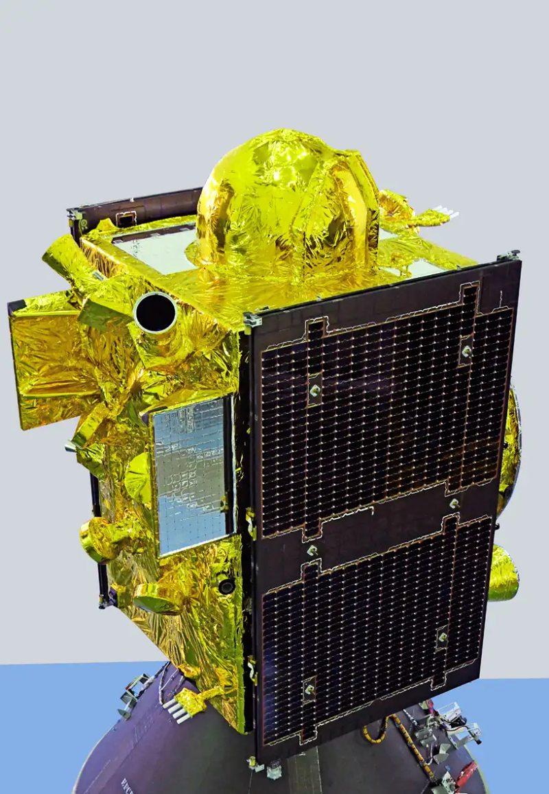
At 11:51 pm on a Friday night in October, the floodlights at India’s Second Launch Pad at Satish Dhawan Space Centre turned a strip of coastal Andhra Pradesh into a stage for a job that sounds mundane and is anything but: telling a phone where it is. The Geosynchronous Satellite Launch Vehicle lifted off carrying 2,250 kilograms of navigation satellite and dropped it into a long elliptical orbit roughly eighteen minutes later. That spacecraft is NVS-03, the third of ISRO’s second-generation navigation satellites, and it puts India’s homegrown positioning system back to the bare minimum of four working spacecraft. Four is not a margin. It is the floor (ISRO, Oct. 2026).
The system is called NavIC, Navigation with Indian Constellation, and for most of its life the satellites wore an older name: IRNSS, the Indian Regional Navigation Satellite System. The program traces back to the Kargil War of 1999, when the United States cut off civilian GPS access to the combat area. India’s answer was to build and own a regional navigation system rather than depend on someone else’s permission to use one: seven spacecraft and the ground stations to run them.
ISRO’s services page puts the performance plainly: position accuracy better than 20 metres and timing better than 50 nanoseconds, both at twice the standard deviation, across the Indian landmass and a ring extending 1,500 kilometres beyond the border. Two services ride on those signals: the open Standard Positioning Service for civilian users, and an encrypted Restricted Service reserved for strategic users. The signals interoperate with GPS, GLONASS, Galileo and BeiDou. One older satellite, IRNSS-1A, now pushes safety-of-life alerts to fishing crews along the coast, where no cell tower reaches (ISRO, Oct. 2026).
Then the fleet fell apart. Nine first-generation satellites went up between 2013 and 2018, and the hardware that followed was less kind. Imported atomic clocks failed on the older spacecraft, and NVS-02 never reached its final orbit after launch. With the operating constellation down to three, NavIC was running below the four-satellite minimum it needs to deliver positioning, navigation and timing at all, and one more failure would have taken the service out (The Hindu, Oct. 31, 2026).
GSLV-F18 went up on a schedule that mattered as much as the rocket. The vehicle, the 20th flight of the GSLV, stacks three stages about 50 metres tall: a solid-fuel core wrapped by four liquid strap-on boosters, a liquid second stage, and a cryogenic upper stage burning liquid hydrogen and liquid oxygen. Lift-off came at 23:51 IST; about thirteen minutes later the vehicle was travelling at 7.1 kilometres per second with the cryogenic stage performing as planned (India Today, Oct. 30, 2026). The spacecraft then does the rest itself, raising itself to geostationary altitude on its own apogee engine and drifting into its slot in the sky.
The industrial story behind those dates is as telling as the flight. The launch campaign took 47 days, the four L40 strap-on boosters were ready in a record 37 days, and the mission came 56 days after the previous GSLV flight, EOS-05 on September 4. Thomas Kurian, the project’s mission director, put it plainly: “We completed the launch campaign in just 47 days and achieved this GSLV launch within 56 days of the previous launch” (ANI, Oct. 31, 2026). Repairing a broken constellation is mostly a question of industrial rhythm.
What NVS-03 carries matters more than the launch that delivered it. Its navigation payload now broadcasts three bands instead of two: the existing L5 signal at 1176.45 MHz and S-band signal at 2498.028 MHz, plus a new L1 signal at 1575.42 MHz (ISRO, Oct. 2026). That last one is a compatibility decision rather than a physics decision. L1 is the frequency that commercial GPS receivers and the chipsets inside ordinary phones already listen for, so a NavIC signal there can be picked up by hardware already in people’s pockets. Without it, every NavIC receiver has to be something different.
The spacecraft also carries a rubidium atomic clock developed in India for navigation use at ISRO’s Space Applications Centre, alongside clocks bought from abroad (The Hindu, Oct. 31, 2026). The earlier IRNSS spacecraft depended on imported Swiss-made atomic clocks, and several of those units failed in orbit. ISRO chairman V. Narayanan said after the launch that one of the homegrown clocks had now been placed in orbit successfully, and that the launch left NavIC “restored to the minimum operational configuration with 4 satellites” (ANI, Oct. 31, 2026).
The constellation is a lesson in geometry, because a clock on its own does nothing for a receiver on the ground. NavIC splits seven spacecraft between two kinds of orbit. Three sit in geostationary orbit, at 32.5 degrees east, 83 degrees east and 129.5 degrees east; four ride inclined geosynchronous orbits of 29 degrees, two in each of two planes whose tracks cross the equator at 55 degrees east and 111.75 degrees east (ISRO, Oct. 2026). A satellite parked directly above the region it serves gives a receiver a narrow spread of elevation angles, flattening the geometry in the vertical direction where errors are largest. The inclined satellites swing well north and south of the equator, restoring the missing angle. Two-dimensional positioning wants three satellites with a usable spread, three dimensions want four, and that is where NavIC was pinned after the failures.
Timing does the rest of the work, and the arithmetic is unforgiving: a receiver measures pseudorange by timing the flight of a signal, and light covers about 30 centimetres in a nanosecond, so the 50-nanosecond timing specification ISRO publishes is the same order of error as 15 metres of range. A 20-metre position error is a clock error wearing a different hat. Only atomic oscillators can hold that budget for a decade in vacuum, which is why the imported clocks failing on the older satellites was a hole in the constellation, not a nuisance.
The ionosphere adds a delay to every signal that varies with solar activity and with the square of frequency, and the cure has been available for decades: broadcast on two frequencies and subtract. NavIC’s L5, S and L1 bands give a receiver two measurements of the same delay, and ISRO publishes the NeQuick-N ionospheric model alongside the signal interface documents so corrections can be computed anywhere in the region. The L1 signal will also let NavIC feed the assisted-GNSS machinery built into mobile networks, specified in the 3GPP standards, which is why NavIC will eventually appear in a phone’s status bar.
The system also thinks about bookkeeping: NavIC’s clock counts from midnight on 22 August 1999, a week-number rollover arrived on 6 April 2019 and burned receivers that had not been updated, and the constellation now runs in its second epoch (ISRO, Oct. 2026).
NVS-04 and NVS-05 are already queued, and Akashvani’s pre-launch note described them as the launches that would fully stabilise the constellation. Until all seven spacecraft are in place, Narayanan said, NavIC will not be integrated into consumer mobile phones. The system already tracks around 10,400 locomotives and 64,000 fishing vessels in real time, with about 1.5 million tracking devices fitted across vehicles (The Hindu, Oct. 31, 2026).
So the twentieth GSLV flight of October 2026 was a repair job of the best kind: it lifted a service back to the minimum specification, carried a clock India can now build for itself, and put a signal on a frequency where the hardware already exists. A constellation is not a capability on the day it launches; it is a capability on the day it still works after the third failure, the imported clock dies, and the country has to send up a replacement.
 Subscribe to our RSS feed









There are no comments.
Add A Comment