


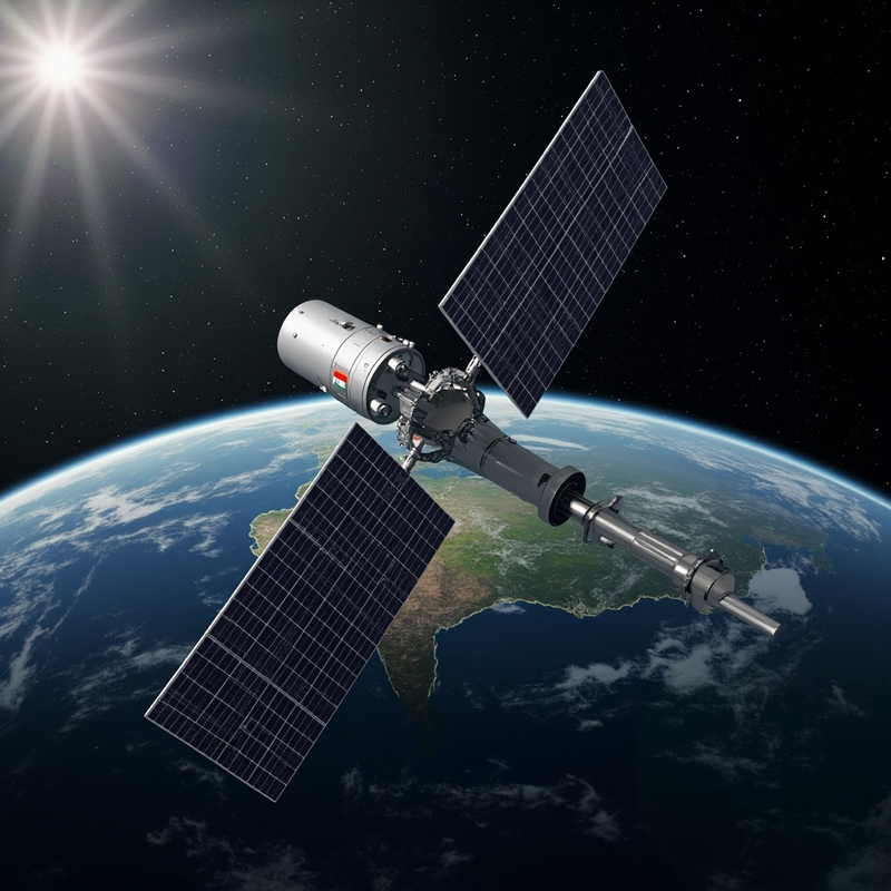
At 02:55 Indian Standard Time on 4 September 2026, the seventeenth operational Geosynchronous Satellite Launch Vehicle — GSLV-F17 — cleared the second launch pad at Sriharikota with a 2,368-kilogram payload, lit its indigenous cryogenic upper stage, and pushed India’s heaviest geostationary passenger into a sub-geosynchronous transfer orbit eighteen minutes later (ISRO mission brochure, August 2026; Wikipedia EOS-05). What makes that routine sentence matter is what the payload is. EOS-05, also known as GISAT-1A, is the first hyperspectral Earth-observing imager ever stationed at geostationary altitude. From roughly 36,000 km above the equator it can sweep the entire Indian landmass every thirty minutes at 42 m resolution and revisit a selected field every five minutes — a cadence no low-Earth-orbit constellation can match for fast-moving hazards.
What changes because of this is the temporal resolution of what India can see. Until now, the country’s civilian Earth-observation stack lived mostly at 600 to 800 km on the IRS series and on a small number of dedicated weather satellites. EOS-05 folds two things into one geostationary platform: near-real-time imaging, and the hyperspectral imaging no civilian operator has flown from GEO before. The combination has no current peer. From 35,786 km, 414 spectral channels are now listening to the subcontinent across visible, near-infrared and short-wave infrared bands, watching floods, fires, crop stress and industrial plumes as they happen rather than as a satellite passes overhead.
The history behind the launch matters. The first GISAT was meant to do exactly this. On 12 August 2021, GSLV-F10 lifted off from the same Sriharikota pad with the 2,268 kg GISAT-1 and its cryogenic upper stage failed to ignite; the satellite burned up over the Bay of Bengal (The Wire, August 2021). ISRO rebuilt the cryogenic engine programme, re-qualified the Cryogenic Upper Stage, and quietly prepared a near-twin spacecraft with refinements drawn from five years of post-failure analysis. EOS-05 carries the same 700 mm Ritchey–Chrétien telescope and I-2K bus as the lost satellite, with upgraded detector thermal control and a more capable onboard formatter. When the same rocket class that failed in 2021 succeeded on 4 September 2026, it completed a five-year recovery that almost no one outside India’s space programme was watching.
What the rocket did after lift-off tells the harder part of the engineering story. GSLV-F17 did not drop EOS-05 at geostationary altitude. It dropped it into a low sub-GTO at around 171 km, a parking orbit deliberately chosen to keep the cryogenic upper stage’s burn time short (Wikipedia EOS-05). From there, the spacecraft used its own apogee motor in three burns over 5, 6 and 7 September to climb to its operational 35,786 km × ~35,786 km geostationary orbit. The two longest burns on 5 and 6 September totalled roughly 5,406 seconds — ninety minutes of cumulative thrust — raising apogee from 20,000 to 31,129 km and then to 35,786 km in stages. This is the standard GEO playbook, but EOS-05 is the heaviest payload GSLV has ever pushed through it.
The optical design is what makes the instrument special. A 700 mm Ritchey–Chrétien primary is small by ground-astronomy standards — Hubble’s mirror is 2.4 m — but it is the largest aperture ISRO has ever flown for Earth observation. From 36,000 km, diffraction-limited resolution scales linearly with aperture and inversely with wavelength, so the trade-off comes down to where you point your photons. EOS-05 splits the available light three ways. The multispectral Visible and Near-Infrared (MX-VNIR) channel uses six broad bands from 0.45 to 0.875 μm and lands at 42 m ground sample distance — the finest spatial resolution any imaging payload has ever delivered from geostationary orbit. The hyperspectral VNIR (HyS-VNIR) channel splits the same window into 158 narrow slices from 0.375 to 1.0 μm at 318 m. The hyperspectral Short-Wave Infrared (HyS-SWIR) channel runs from 0.9 to 2.5 μm across 256 bands at 191 m. Adding 158 and 256 gives 414 hyperspectral channels; with the six multispectral bands stacked on top, the total detector count exceeds 420.
The reason that matters is spectroscopy. A multispectral imager sees colour; a hyperspectral imager sees chemistry. Mineral dust has a different spectral signature than volcanic ash; healthy vegetation has a sharp red-edge near 0.7 μm; a chlorinated industrial plume absorbs differently than a hydrocarbon one. From low Earth orbit, agencies have done this for decades — NASA’s Hyperion on EO-1, ESA’s EnMAP, the Italian Space Agency’s PRISMA hypersatellite — but those satellites revisit a given point every few days at best. EOS-05 is the first time the world has had that chemical sensitivity continuously, watching one continent, refreshed every thirty minutes. A cyclone making landfall on the Odisha coast, a methane plume from a gas flare in Assam, a crop pest outbreak spreading through Punjab — all become things that can be detected within a single orbit of the satellite above.
The engineering trade-offs behind those numbers come down to two constraints. First, photon budget: a 700 mm mirror at 36,000 km gathers roughly the same per-unit-area flux as a small ground telescope, and the satellite stares at any given scene for tens of seconds rather than the milliseconds a LEO sensor collects per pass. The HyS-SWIR bands pay for that penalty with coarser spatial resolution (191 m instead of 42 m) and wider spectral slices. Second, thermal stability: a hyperspectral detector must hold its wavelength calibration to a fraction of a band over hours of stare time, so EOS-05 carries a closed-cycle cooler that pins the SWIR focal plane near 150 K. Without it, the 256 SWIR channels would smear into noise within minutes of eclipse exit.
What this changes is the cadence of Indian disaster response and agricultural monitoring. The Indian National Disaster Management Authority, the Indian Agricultural Research Council, and state forest departments will receive a continuous stream of 42 m imagery refreshed every thirty minutes over the entire country — a temporal density no civilian operator on Earth could match from GEO before this year. The same data feeds weather models through cloud-motion winds and aerosol optical depth retrievals that no other geostationary weather satellite can currently produce, because none of them carry hyperspectral imagers. The six-band MX-VNIR will provide what the older INSAT-3DR can only approximate in coarse thermal IR; the 414 hyperspectral channels will provide what the LEO hyperspectral fleet cannot — continuity.
Two other satellites are still on ISRO’s drawing board for the GISAT series — GISAT-2 and a planned third. For the next few years, EOS-05 will sit alone at 36,000 km, pointing its 700 mm mirror at one subcontinent, and rewriting what Earth observation means when you can watch a country breathe.
 Subscribe to our RSS feed









There are no comments.
Add A Comment