The European Union’s Global Monitoring for Environment and Security (GMES) initiative was born as the result of a growing need for accurate and accessible information about the environment, the effects of climate change, and civil security. GMES uses as its main information feed the data collected by satellites developed by ESA. Data is also collected by instruments carried by aircraft, floating in the ocean, or located on the ground.
GMES provides services that can be grouped into five main categories: land management, marine environment, atmosphere, aid emergency response, and security.
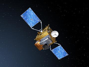
There are five Sentinel missions designed as components of the GMES initiative. These missions will complement the national initiatives of the EU members involved. The missions will collect data for land and ocean monitoring, and atmospheric composition monitoring, making use of all-weather radar and optical imaging. Each of the Sentinel missions is based on a constellation of two satellites.
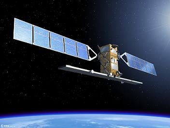
Sentinel-1 is an all-weather radar-imaging mission. The satellites will have polar orbits and collect data for the GMES land and ocean services. The first satellite is scheduled for launch in 2012. Sentinel-1 will ensure the continuity of Synthetic Aperture Radar (SAR) applications, taking over from systems carried by ERS-1, ERS-2, Envisat, and Radarsat. Sentinel-1 satellites will be carried to orbit by Soyuz launch vehicles lifting off from Kourou.
Sentinel-2 will provide high-resolution multi-spectral imagery of vegetation, soil, and water, and will cover inland waterways and coastal areas. Sentinel-2 is designed for the data continuity of missions like Landsat or SPOT (Satellite Pour l’Observation de la Terre). Each satellite will carry a Multi-Spectral Imager (MSI) that can ‘see’ in thirteen spectral bands spanning from the visible and near infrared (VNIR) to the shortwave infrared (SWIR). The first Sentinel-2 is planned to launch in 2013. Vega will provide launch services for Sentinel-2 missions.
Sentinel-3 will determine parameters such as sea-surface topography and sea and land surface temperature. It will also determine ocean and land colour with high accuracy. The first Sentinel-3 satellite is expected to reach orbit in 2013. The spacecraft bus has a three-meter accuracy real-time orbit determination capability based on GPS and Kalman filtering.
Sentinel-4 is devoted to atmospheric monitoring and it will consist of payloads carried by Meteosat Third Generation (MTG) satellites that are planned to launch in 2017 and 2024. Sentinel-5 will be used for atmospheric monitoring as well. The payload will be carried by a post-EUMETSAT Polar System (EPS) spacecraft, planned to launch in 2020. A Sentinel-5 precursor will ensure that no data gap will exist between the Envisat missions and Sentinel-5.
You can find out more about the GMES initiative and the Sentinel missions on a dedicated page on ESA’s website.


 Subscribe to our RSS feed


There are no comments.
Add A Comment