 |
| Credits: ESA – P. Carril |
In 2007, projections of sea level rise made by the Fourth Assessment Report of the Intergovernmental Panel on Climate Change were in the range of 28–43 cm by 2100, but there are new projections of the sea level rise that are in the order of 1.4 m.
While the trend is quite obvious, it is very important to be able to make accurate predictions.
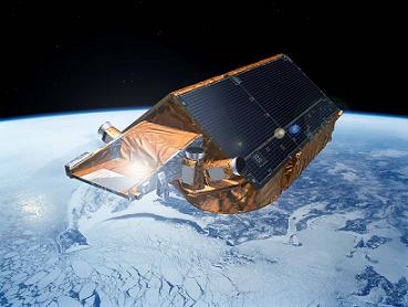
Cryosat has been designed to measure the ice thickness on land and also at sea, and will provide enough data so that a precise rate of change of the ice thickness can be determined. A better understanding of how the volume of ice on Earth is changing will also be possible.
The declared primary goals of the CryoSat mission are to determine the regional trends in Arctic perennial sea-ice thickness and mass, and to determine the contribution that the Antarctic and Greenland ice sheets are making to mean global rise in sea level. Cryosat will also measure the variations in the thickness of Earth’s polar caps and glaciers. The spacecraft will be operational for a minimum of three years.
 |
| Credits: ESA/P. Carril |
The spacecraft has a launch mass of 720 kg, of which 23 kg is the fuel required for orbital maneuvers and attitude corrections. The overall size of the spacecraft is 4.6 m x 2.34 m. Two solar panels are attached to the spacecraft’s body and provide a maximum of 800 W of power. As the CryoSat-2 orbit is not Sun-synchronous, providing enough power to the scientific payload has been a considerable challenge.
The operational orbit will be a 717 km non Sun-synchronous orbit with a 92 degree inclination.
The primary payload of the CryoSat-2 spacecraft is the SAR/Interferometric Radar Altimeter (SIRAL). In order to have the position of the spacecraft accurately tracked, a radio receiver called Doppler Orbit and Radio Positioning Integration by Satellite (DORIS) and a laser retro-reflector are part of the payload as well. A global network of laser ranging stations (the International Laser Ranging Service or ILRS for short) will support the mission. Three star-trackers will ensure a proper orientation of the spacecraft.
Using the Synthetic Aperture technique, CryoSat-2 measurements taken by SIRAL will have a 250 m resolution in the along-track direction. The instrument is designed to operate in three measurement modes: Low Resolution Mode (LRM) mostly over the oceans, Synthetic Aperture Radar (SAR) mode over sea-ice areas, and SAR Interferometric (SARIn) mode over steeply sloping ice-sheet margins, small ice caps, and mountain glaciers.
 |
| Credits: ESA – AOES Medialab |
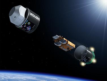
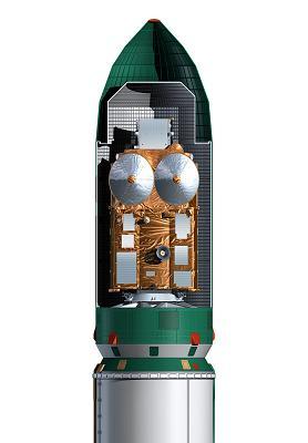
CryoSat-2 will be placed in orbit by a Dnepr launch vehicle. With a lift-off mass of 211 tons, Dnepr is 34 m long and 3 m in diameter, and has three stages that use hypergolic liquid propellants (N2O4 nitrogen peroxide and UDMH unsymmetrical dimethylhydrazine). In addition, there are Dnepr configurations with a third and a fourth stage for missions that require more energy. The launch vehicle is based on an ICMB designated as SS-18 Satan by NATO. The development and commercial operation of the Dnepr Space Launch System is managed by the International Space Company (ISC) Kosmotras. Dnepr can lift 4,500 kg to low Earth orbit (LEO) or 2,300 kg to a 98 degree Sun-synchronous orbit. Among other satellites launched by Dnepr are Demeter, Genesis I, Genesis II, and THEOS. Dnepr, carrying Cryosat-2, will lift off from Baikonur Cosmodrome in Kazakhstan.


 Subscribe to blog posts using RSS


