OrbitalHub

The place where space exploration, science, and engineering meet

Domain is for sale. $50,000,000.00 USD. Direct any inquiries to contact@orbitalhub.com.

Archive for the Robotic Exploration category

October 8, 2017

Lonely Moon

Posted by


NASA dixit:

“August 12, 2016. Pandora is seen here, in isolation beside Saturn’s kinked and constantly changing F ring. Pandora (near upper right) is 50 miles (81 kilometers) wide. The moon has an elongated, potato-like shape. Two faint ringlets are visible within the Encke Gap, near lower left. The gap is about 202 miles (325 kilometers) wide. The much narrower Keeler Gap, which lies outside the Encke Gap, is maintained by the diminutive moon Daphnis (not seen here).

This view looks toward the sunlit side of the rings from about 23 degrees above the ring plane. The image was taken in visible light with the Cassini spacecraft narrow-angle camera. The view was acquired at a distance of approximately 907,000 miles (1.46 million kilometers) from Saturn and at a Sun-Saturn-spacecraft, or phase, angle of 113 degrees. Image scale is 6 miles (9 kilometers) per pixel.”

Image credit: NASA/JPL-Caltech/Space Science Institute


  • Facebook
  • Google
  • Slashdot
  • Reddit
  • Live
  • TwitThis
October 7, 2017

Flowing Dunes of Shangri-La

Posted by


NASA dixit:

“July 25, 2016. In the Shangri-La Sand Sea on Titan is shown in this image from the Synthetic Aperture radar (SAR) on NASA’s Cassini spacecraft. Hundreds of sand dunes are visible as dark lines snaking across the surface. These dunes display patterns of undulation and divergence around elevated mountains (which appear bright to the radar), thereby showing the direction of wind and sand transport on the surface. Sands being carried from left to right (west to east) cannot surmount the tallest obstacles; instead, they are directed through chutes and canyons between the tall features, evident in thin, blade-like, isolated dunes between bright some features. Once sands have passed around the obstacles, they resume their downwind course, at first collecting into small, patchy dunes and then organizing into larger, more pervasive linear forms, before being halted once again by obstacles.

These patterns reveal the effects not only of wind, perhaps even modern winds if the dunes are actively moving today, but also the effects of underlying bedrock and surrounding topography. Dunes across the solar system aid in our understanding of underlying topography, winds and climate, past and present. Similar patterns can be seen in dunes of the Great Sandy Desert in Australia, where dunes undulate broadly across the uneven terrain and are halted at the margins of sand-trapping lakes. The dune orientations correlate generally with the direction of current trade winds, and reveal that winds must have been similar back when the dunes formed, during the Pleistocene glacial and interglacial periods.

North on Titan is up in the image. Radar illuminates the scene from upper right at a 27-degree incidence angle. The image was obtained during the mission’s 122nd targeted Titan encounter.”

Image credit: NASA/JPL-Caltech/Space Science Institute


  • Facebook
  • Google
  • Slashdot
  • Reddit
  • Live
  • TwitThis
October 6, 2017

Regarding Rhea

Posted by


NASA dixit:

“June 3, 2016. Rhea, like many moons in the outer solar system, appears dazzlingly bright in full sunlight. This is the signature of the water ice that forms most of the moon’s surface. Rhea (949 miles or 1,527 kilometers across) is Saturn’s second largest moon after Titan. Its ancient surface is one of the most heavily cratered of all of Saturn’s moons. Subtle albedo variations across the disk of Rhea hint at past geologic activity.

This view looks toward the anti-Saturn hemisphere of Rhea. North on Rhea is up and rotated 36 degrees to the right. The image was taken with the Cassini spacecraft narrow-angle camera using a spectral filter which preferentially admits wavelengths of ultraviolet light centered at 338 nanometers. The view was acquired at a distance of approximately 365,000 miles (587,000 kilometers) from Rhea and at a Sun-Rhea-spacecraft, or phase, angle of 9 degrees. Image scale is 2.4 miles (3.9 kilometers) per pixel.”

Image credit: NASA/JPL-Caltech/Space Science Institute


  • Facebook
  • Google
  • Slashdot
  • Reddit
  • Live
  • TwitThis
October 5, 2017

Not Really Starless at Saturn

Posted by


NASA dixit:

“April 2, 2016. Saturn’s main rings, along with its and moons, are much brighter than most stars. As a result, much shorter exposure times (10 milliseconds, in this case) are required to produce an image and not saturate the detectors of the imaging cameras on NASA’s Cassini spacecraft. A longer exposure would be required to capture the stars as well. Cassini has captured stars on many occasions, especially when a target moon is in eclipse, and thus darker than normal. Dione (698 miles, 1123 kilometers across) and Epimetheus (70 miles, 113 kilometers across) are seen in this view, above the rings at left and right respectively.

This image looks toward the sunlit side of the rings from about 3 degrees above the ring plane. The image was taken in visible light with the Cassini spacecraft wide-angle camera. The view was obtained at a distance of approximately 257,000 miles (413,000 kilometers) from Saturn and at a Sun-Saturn-spacecraft, or phase, angle of 34 degrees. Image scale is 15 miles (25 kilometers) per pixel.”

Image credit: NASA/JPL-Caltech/Space Science Institute
 

  • Facebook
  • Google
  • Slashdot
  • Reddit
  • Live
  • TwitThis
October 4, 2017

Examining Epimetheus

Posted by


NASA dixit:

“December 6, 2015. NASA’s Cassini spacecraft captured this view of Saturn’s moon Epimetheus (116 kilometers, or 72 miles across) during a moderately close flyby. This is one of Cassini’s highest resolution views of the small moon. This view looks toward the Saturn facing side of Epimetheus. North on Epimetheus is up. The image was taken in green polarized light with the Cassini spacecraft narrow-angle camera.

The view was acquired at a distance of approximately 22,000 miles (35,000 kilometers) from Epimetheus and at a Sun-Epimetheus-spacecraft, or phase, angle of 28 degrees. Image scale is 697 feet (212 meters) per pixel.”

Image credit: NASA/JPL-Caltech/Space Science Institute


  • Facebook
  • Google
  • Slashdot
  • Reddit
  • Live
  • TwitThis
October 3, 2017

Three Times the Fun

Posted by


NASA dixit:

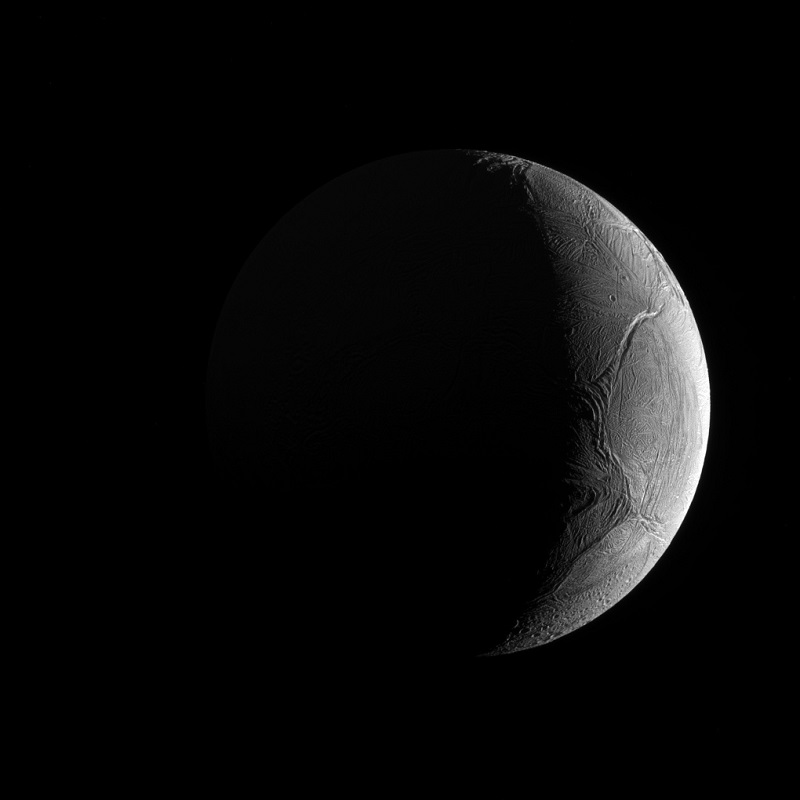
“December 3, 2015. Three of Saturn’s moons, Tethys, Enceladus, and Mimas, are captured in this group photo from NASA’s Cassini spacecraft. Tethys (660 miles or 1062 kilometers across) appears above the rings, while Enceladus (313 miles or 504 kilometers across) sits just below center. Mimas (246 miles or 396 kilometers across) hangs below and to the left of Enceladus.

This view looks toward the sunlit side of the rings from about 0.4 degrees above the ring plane. The image was taken in visible light with the Cassini spacecraft narrow-angle camera. The view was acquired at a distance of approximately 837,000 miles (1.35 million kilometers) from Enceladus, with an image scale of 5 miles (8 kilometers) per pixel. Tethys was approximately 1.2 million miles (1.9 million kilometers) away with an image scale of 7 miles (11 kilometers) per pixel. Mimas was approximately 1.1 million miles (1.7 million kilometers) away with an image scale of 6 miles (10 kilometers) per pixel.”

Image credit: NASA/JPL-Caltech/Space Science Institute


  • Facebook
  • Google
  • Slashdot
  • Reddit
  • Live
  • TwitThis