OrbitalHub

The place where space exploration, science, and engineering meet

Domain is for sale. $50,000,000.00 USD. Direct any inquiries to contact@orbitalhub.com.


Wikipedia dicit:

The Surface Water and Ocean Topography (SWOT) mission is a satellite altimeter jointly developed and operated by NASA and CNES, the French space agency, in partnership with the Canadian Space Agency (CSA) and UK Space Agency (UKSA). The objectives of the mission are to make the first global survey of the Earth’s surface water, to observe the fine details of the ocean surface topography, and to measure how terrestrial surface water bodies change over time.

While past satellite missions like the Jason series altimeters (TOPEX/Poseidon, Jason-1, Jason-2, Jason-3) have provided variation in river and lake water surface elevations at select locations, SWOT will provide the first truly global observations of changing water levels, stream slopes, and inundation extents in rivers, lakes, and floodplains. In the world’s oceans, SWOT will observe ocean circulation at unprecedented scales of 15–25 km (9.3–15.5 mi), approximately an order of magnitude finer than current satellites. Because it uses wide-swath altimetry technology, SWOT will almost completely observe the world’s oceans and freshwater bodies with repeated high-resolution elevation measurements, allowing observations of variations.

Credit: NASA/JPL-Caltech/CNES


  • Facebook
  • Google
  • Slashdot
  • Reddit
  • Live
  • TwitThis
01-10-10

Arianespace 30th Anniversary

Posted by


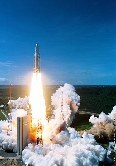
Credits: ESA/CNES/Arianespace – Optique vidéo du CSG, L. Boyer


Arianespace was founded in 1980. With twenty-four shareholders from ten European countries (among which CNES holds 34% and EADS 30%), Arianespace is the world’s first commercial space transportation company.


The workhorse of Arianespace has been the Ariane launch vehicle.


Five versions of Ariane have served the company so far: Ariane 1, with the first successful launch on December 24, 1979, Ariane 2, launched for the first time on November 20, 1987, Ariane 3, starting its service on August 4, 1984, Ariane 4, launched on June 15, 1988, and Ariane 5, with the first successful flight on October 30, 1997.


The first launch of Ariane 5, a.k.a. Flight 501, ended with the vehicle being destroyed by its automated self-destruct system, after the high accelerations caused the inertial guidance system to crash. The crash was caused by, I quote, one of the most infamous computer bugs in history. If you like, you can take a look at the Ada code that caused the malfunction. But enough with the dark memories, this is an anniversary after all…


Since its inception, Arianespace has signed over 300 contracts that resulted in more than 277 satellite launches. According to Arianespace, Ariane launchers have delivered more than half of all commercial satellites now in service. The year 2009 was a very successful year for Ariane 5. The launcher orbited nine commercial satellites, the Herschel space telescope, the Planck scientific observatory, and the Helios 2B observation satellite. Ariane 5 has proven to be a versatile launch vehicle, capable of handling a wide range of missions.


The challenges for 2010 are many, as Arianespace is planning up to seven Ariane 5 launches. Two new launch vehicles will join Ariane 5 as part of the Arianespace family of launchers: the Vega small launcher and the Soyuz medium launcher.


You can read more about Arianespace, its mission, and the solutions provided to customers around the world on the Arianespace website.


  • Facebook
  • Google
  • Slashdot
  • Reddit
  • Live
  • TwitThis
06-19-09

SMOS

Posted by


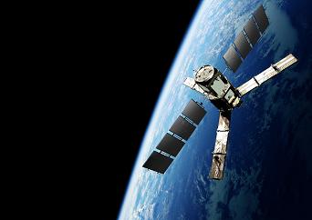
Credits: ESA-AOES Medialab


The Soil Moisture and Ocean Salinity (SMOS) mission, which is the second Earth Explorer Opportunity mission to be developed as part of ESA’s Living Planet Program, will provide global maps of moisture over the Earth’s landmasses and salinity over the oceans. These observations will improve our understanding of hydrology and ocean circulation patterns.


The science objectives for the SMOS mission are global monitoring of surface soil moisture and surface salinity over oceans, and improving the characterization of ice and snow-covered surfaces.


The SMOS satellite is built around a standard spacecraft bus called Proteus, which was developed by the French space agency CNES (Centre National d’Etudes Spatiales) and Alcatel Alenia Space. Proteus measures one cubic meter and plays the role of a service module, hosting all the subsystems that are required for the satellite to function.


A GPS receiver collects satellite position information. A hydrazine monopropellant system consisting of four 1-Newton thrusters, which are mounted on the base of the spacecraft, provides the thrust for orbit control. Three 2-axis gyroscopes and four small reaction wheels control the attitude of the satellite. A star tracker also provides accurate attitude information for instrument measurements.


The solar panels can produce up to 900 W, covering the 525 W maximum payload consumption. During eclipse periods, the satellite uses a 78 AH Li-ion battery. SMOS has a launch mass of 658 kg: a 275 kg platform, 355 kg payload, and 28 kg of fuel.


The SMOS satellite will deploy a new type of scientific instrument in space: a microwave imaging radiometer that operates between 1,400 – 1,427 MHz (L-band). The instrument is called Microwave Imaging Radiometer using Aperture Synthesis, or MIRAS, for short. MIRAS consists of a central structure and three deployable arms, and uses 69 antenna-receivers (LICEFs) for measuring microwave radiation emitted from the surface of the Earth. The instrument is the result of almost ten years of research and development.
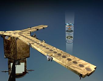
 

Credits: ESA-AOES Medialab


The data collected by MIRAS needs to go through a validation process. The radiation received by the instrument is a function that depends not only on soil moisture and ocean salinity, other effects need to be considered when instrument data is converted into units of salinity and moisture.


Factors that have to be considered are the distribution of vegetation, the litter layer, the soil type, the varying roughness of the surface, and the physical temperature of the surface of the land and sea.


In order to quantify the effects of factors mentioned above, dedicated campaign activities were conducted. Ground-based and airborne instruments similar to the one mounted on SMOS were used to collect data that was correlated with in-situ observations made by large ground teams. Long-term observations were carried out from an oilrig platform in the Mediterranean and at the Concordia Station in Antarctica.


The Committee on Earth Observation Satellites (CEOS) has defined a number of levels for the SMOS Mission Data Products. They range from Raw Data to Level-3 Data Products, which are Soil Moisture and Ocean Salinity global maps. Level-3 data will be available from the SMOS Level 3/4 Processing Center in Spain.


Eurockot will provide the launch services for the SMOS mission. A Rockot launcher, which is derived from a Russian Intercontinental Ballistic Missile (ICBM) SS-19, will lift off from the Plesetsk Cosmodrome, 800 km north of Moscow. The Rockot launcher will inject the satellite in a 758 km quasi-circular orbit.


The CNES Satellite Operations Ground Segment and ESA/CDTI (Centro para el Desarrollo Technologico Industrial) Data Processing Ground Segment will be responsible for the SMOS mission ground segment.


Initially scheduled for 2008, the launch of the Earth Explorer SMOS satellite will take place some time from July to October 2009.


You can find more details about SMOS on the dedicated page on ESA’s web site.


  • Facebook
  • Google
  • Slashdot
  • Reddit
  • Live
  • TwitThis
03-30-09

ESA Conference On Space Debris

Posted by


Credits: ESA


The Fifth European Conference on Space Debris is hosted by ESA. The conference takes place at ESA’s Space Operations Centre (ESOC) in Darmstadt, Germany, for four days beginning March 30.


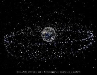
The space debris in Earth orbit has been attracting attention due to the direct threat that it poses to current and future space missions. Long-term protection of the low-Earth and geosynchronous orbital zones is essential for the development of commercial activities in space.


“Our ability to safely use outer space in the long term is not guaranteed,” said Gerard Brachet, a past Chairman of the UN Committee on the Peaceful Uses of Outer Space (UNCOPUOS), speaking during today’s opening speech. He added that: “Increased crowding in low Earth orbits as well as the geostationary orbit creates new challenges.”


The first artificial satellite was launched in 1957 by the Soviet Union. Since then, almost 5000 launches have placed around 6000 satellites into orbit. Today, the 800 operational satellites count for only six percent of the catalogued orbit population. Decommissioned satellites, spent upper stages, mission-related objects, and fragments make up the rest. More than half of the debris originates from around 200 fragmentations that occurred in orbit. Except for few accidental collisions, these fragmentations were explosions of spacecraft and upper stages.


Mitigation measures have to be implemented. Among these, reducing the number of explosions, minimizing the number of objects released during spacecraft operations (also known as mission-related objects or MRO), re-orbiting satellites, and returning spacecraft and rocket stages to Earth after completion of their mission.


The main sponsor of the conference is ESA and co-sponsors are the Italian space agency (ASI), the British National Space Centre (BNSC), the French space agency (CNES), the German Aerospace Center (DLR), the Committee on Space Research (COSPAR), and the International Academy of Astronautics (IAA).


For more details about the conference, you can visit the ESA website.


  • Facebook
  • Google
  • Slashdot
  • Reddit
  • Live
  • TwitThis


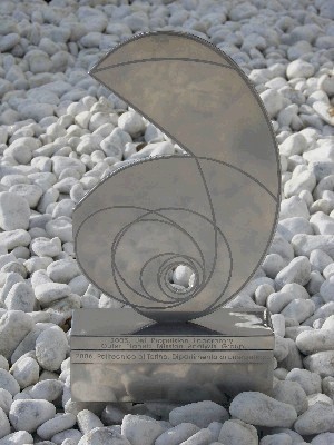
Credits: CNES


In 2005, ESA’s Advanced Concepts Team held its first Global Trajectory Optimization Competition (GTOC). The purpose of the competition is to stimulate research of techniques for finding the optimal trajectory for different space missions.


What is interesting about this competition is how it has been taken up by the community after its first edition. The winners of the competition become the hosts for the next edition.


The first edition of the competition was won by the Outer Planets Mission Analysis Group of JPL. The second edition was won by the Department of Energetic in the Polytechnic of Turin, and the third edition was won by CNES (Centre National d’Etudes Spatiales).


CNES has announced the 4th Edition of the GTOC. We quote this year’s announcers of the competition, Regis Bertrand, Richard Epenoy, and Benoit Meyssignac:


“Mission designers generally solve trajectory optimisation problems by means of local optimisation methods together with their own experience of the problem. Even if this way is known to provide good results, it never guarantees to yield the global optimum. On the other hand, global optimisation techniques can offer significant assistance in finding an acceptable solution to a given problem, even though convergence to the global optimum is still not guaranteed. By focusing on a problem with a very large number of locally optimal solutions, the Global Trajectory Optimisation Competition promotes the development of methods that most thoroughly and most quickly search through a large and unconventional design space for optima.”


The deadline for registration is February 27, 2009. On March 2, 2009, the competition problem will be disclosed, and March 30, 2009, is the deadline for return of solutions. In September 2009, during a one-day workshop held in Toulouse, France, the teams selected will present their methods and solutions.


  • Facebook
  • Google
  • Slashdot
  • Reddit
  • Live
  • TwitThis


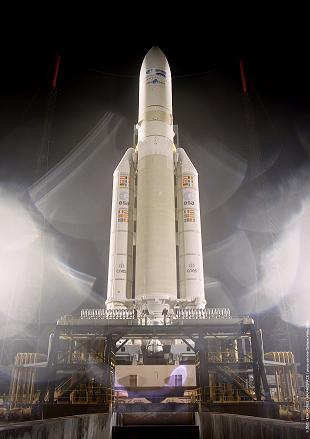
Credits: ESA/CNES/ARIANESPACE-Service Optique CSG 2002


Arianespace accounted for 50 percent of all commercial launches to geostationary transfer orbit during 2008 and retained its strong market share, which represented 72 percent of the orders booked in 2008.


Arianespace was founded in 1980. Among its 23 shareholders are the French space agency CNES with thirty-four percent and EADS Astrium with thirty percent. With only around 300 employees, the company has generated sales of about one billion euros in 2008.


2009 will be the year of the launcher family for Arianespace, as Arianespace Chairman and CEO Jean-Yves Le Gall pointed out during the company’s New Year’s press conference in Paris. The development of the Vega launcher is being finalized, the maiden launch of the medium-lift Soyuz launcher from Kourou in French Guiana will take place this year, and more than six missions are scheduled for Ariane 5.


“As a result of our launcher family strategy, Arianespace has a sustained agility that allows us to be ever more responsive to our customers,” Le Gall told the journalists. “The agility has been demonstrated with our 28 consecutive mission successes for Ariane 5 and the 21 for Soyuz – and is underscored by launches that are on target, and on time.”


With a full range of payload lift capabilities, including Vega, Soyuz, and Ariane 5, Arianespace is able to meet the changing trends in satellite weights, orbiting everything from light weight scientific payloads to heavy telecommunication relay platforms.


  • Facebook
  • Google
  • Slashdot
  • Reddit
  • Live
  • TwitThis